• CLASSIC SAILFLOW
    Classic myiKitesurfClassic Wind & Weather maps and graphs
Hello Guest
 • 

Classic iKitesurf  
Hi guest · Get your free membership now · Log In ·
Columbia River Bar
 > Current Wind Graph
 > Meteogram
 > Onsite Report
 > Wind Yesterday
 > Last 7 Days
 > Wind Archive
 > Wind Alert
OR - coast

Human Forecasts
 > Daily Briefing

Real-Time Data
 > Dynamic Map
 > Radar Map
 > Wind Obs Summary

Computer Forecasts
 > Model Tables
 > Wind Forecast Map
 > Radar Map
 > Tidal Currents Map

More Maps

Other Resources

Watches/Warnings
>None Active


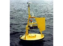
This buoy is located at 46.12N 124.51W making it a "nearshore" indicator of swell and wind data. It is stationed approx. 15 to 20 miles off the Oregon Coast atop the Columbia River Bar. It is highly useful for determining what type of beach conditions one will encounter in the short term.
Local Expert? edit Edit this Page!
Shops, Schools, Clubs, Events, Food, Lodging, More,

Data from this station is courtesy of NOAA's National Data Buoy Center.

© Copyright 2025 WeatherFlow, Inc · Contact Us ·