• CLASSIC SAILFLOW
    Classic myiKitesurfClassic Wind & Weather maps and graphs
Hello Guest
 • 

Classic iKitesurf  
Hi guest · Get your free membership now · Log In ·
Oregon Buoy
 > Current Wind Graph
 > Meteogram
 > Onsite Report
 > Wind Yesterday
 > Last 7 Days
 > Wind Archive
 > Wind Alert
OR - coast

Human Forecasts
 > Daily Briefing

Real-Time Data
 > Dynamic Map
 > Radar Map
 > Wind Obs Summary

Computer Forecasts
 > Model Tables
 > Wind Forecast Map
 > Radar Map
 > Tidal Currents Map

More Maps

Other Resources

Watches/Warnings
>None Active


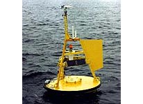
This buoy is located at 42.52N 130.32W making it an "offshore" indicator of swell and wind data. It is stationed approx. 300 miles off the Oregon Coast due west of Coos Bay. Mainly used for determining what type wind and swell patterns will set up in the next 24 to 48 hrs.
Local Expert? edit Edit this Page!
Shops, Schools, Clubs, Events, Food, Lodging, More,

Data from this station is courtesy of NOAA's National Data Buoy Center.

© Copyright 2025 WeatherFlow, Inc · Contact Us ·